MTB Samoborsko gorje: Japetić – Oštrc – Old town Lipovec

Country: Croatia
Mountain: Samoborsko gorje
Length: 42 km
Elevation gain: 1450 m
Maximum elevation
:  840 m
Technical difficulty: 4/5
Download GPS Track: Samoborsko gorje_Japetic_Oštrc_Lipovec_Cyclotrail
Date of ride: 28.03.2021.
Suitable for E-bike: Yes

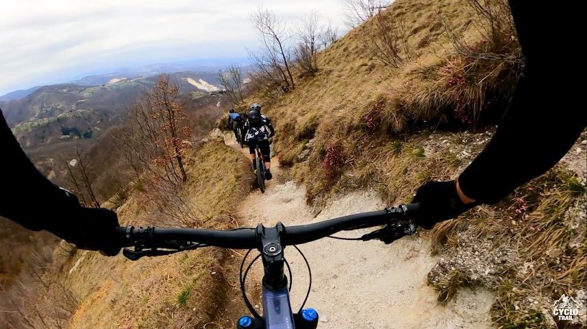
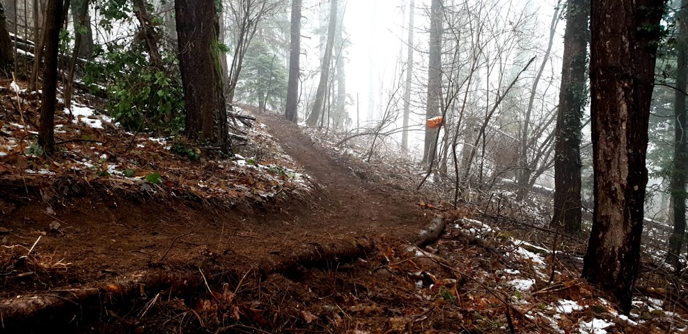
This time we decided to visit Japetić, Oštrc and old town Lipovec. For ascent on Japetić we choose probably easiest way by paved road, and then descended on the side were peregliders  go into the air. This is first of our three descents, and it ends near “Šoićeva kuća” (Šoić House). From there we went to Oštrc, and for ascent we used unpaved road which later becomes technical singletrack, we managed to pedal all the way beneath “Ptičji vrh” (“Bird peak”) and from there descended with Hofman put (Hofman trail), and then after  1 km we connected to the same trail that we used for ascent and went for Željezničar hut.
(more…)

Continue ReadingMTB Samoborsko gorje: Japetić – Oštrc – Old town Lipovec

Medvednica VTC: Tonchek & Tochkica i Blek Stena

Country: Croatia
Mountain: Medvednica
Length: 17,5 km
Elevation gain: 810 m
Maximum elevation
:  650 m
Technical difficulty: 3/5
Download GPS Track: T&T i Blek Stena_Cyclotrail
Date of ride: 10.04.2021.
Suitable for E-bike: Yes

I remember first time when I visited east part of Medvednica. It was winter, and snow covered everything in Zagreb. We decided to visit Gorščica and it was one of the best and most genuine experiences on Medvednica mountain. At the hut Gorčica we ended with knives in our hands peeling potatoes  with the host who then made us pancakes and he didn’t  want to take any money from us. That was the first time on Medvednica mountain that I felt like I’m in someone’s house and not in a restourant.
Now, concession ended for hosts, but they still give service in smaller hut nearby old shelter. They sell drinks, strudels and best pancakes (for only 5 kunas, which is only 0,65 euros).

(more…)

Continue ReadingMedvednica VTC: Tonchek & Tochkica i Blek Stena

MTB Učka – Vojak – Deda – st.Anton – Kraj

Country: Croatia
 Mountain: Učka
Length: 47,5 km
Elevation gain: 1592 m
Maximum elevation:  1396 m
Technical difficulty: 4/5
Download GPS Track: Ucka_Vojak_Deda_st.Anton_Kraj_Cyclotrail
Date of ride: 31.10.2020.
Suitable for E-bike: Yes

Last year I went on Mala Učka and rode with Ivan, Gojsi and Hrvoje. We chose one of the easier descents that Učka mountain has to offer. This time I came back with friends. We were accompanied with crew (Matko, Dule and Luka) from Rijeka who shuttled to Poklon. We started from Ika (There is a parking lot behind Konzum market) and from there went uphill on paved road. I was relieved that we pedaled to Vojak by asphalt road because I haven’t rode bike for 3 weeks, and one week had a flu, so I lost my form.  This lost of form cost me later very dear on long descent.

(more…)

Continue ReadingMTB Učka – Vojak – Deda – st.Anton – Kraj