Hajnževo sedlo & Zelenjak

Country: Slovenia
Region: Ljubelj
Length: 22,6 km
Elevation gain: 1816m
Maximum elevation:
  1920 m
Technical difficulty: 5/5
Download GPS Track: Hajnževo sedlo i zelenjak
Date of ride: 27.07.2024.
Suitable for E-bike: Yes

Our initial plan was to ride Kofce, but due to popularity of this trail, we decided to postpone our trip, and to go on the other side of the same mountain to somewhat more secluded place than Kofce. I got three gpx tracks which I combined into one track. Plan was to visit Hajnževo saddle, Zelenjak and to ride Bornov pot. Later we canceled the last one. These gpx files I got from Aleš, he is Slovenian mountain biker, and probably a guy who biked almost everything in Slovenia and he is always helpful when I have some questions (which is lately very often). This is his region, so he investigated these parts in detail. When I got those gpx files, I decided to put them all in one trip. 
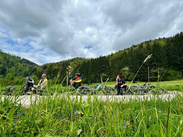
We parked our car in a parking lot just before the tunnel and soon started our journey. First destination is Hajnževo sedlo (saddle). First part is on gravel road. About 3 km of steepest gravel road I ever rode. Almost all the time inclination is 20% and above. After reaching some sheperd’s house starts singletrail which lasts about 1 km, and leads directly to saddle. We end our ascent at the beginning of the ferrata, which leads to Veliki vrh (peak we intended to climb by bike, but from the other side).
(more…)

Continue ReadingHajnževo sedlo & Zelenjak

Kranj/Preddvor – Incredible trails

Country: Slovenia
Region: Kranj
Length: 34 km
Elevation gain: 1820m
Maximum elevation:
  1420 m
Technical difficulty: 4/5
Download GPS Track: Kranj_incredible trails_Cyclotrail
Date of ride: 02.06.2024.
Suitable for E-bike: Yes

When we decided to go in Preddvor to ride local trails, I didn’t expect that second trail would be one of the best trails I have ever ridden. I had gpx track for second trail and from the video I knew that this trail would be interesting, but ascent and descent combined had about 700 meters of elevation gain and about 15 km lenght. It was to little to ride and to travel from Zagreb, so I added one ascent and descent which I drew blindly not knowing the terrain.  At the end we got about 1800 elevetion gain and about 12 km of bike trails. First part is on paved road, later we connect to gravel road which is very very steep almost all the time. Luckily we were on e-bikes so it was easier for us. At 7th kilometer we connected to the trail that leads to both descents. First part of that trail wich leads to intersection to the second descent is rideable with electric bike, but after that intersection becomes even more steep, so we had to push our bikes.

(more…)

Continue ReadingKranj/Preddvor – Incredible trails

Kamnik – The ridge trail

Country: Slovenia
Mountain: Kamnik
Length: 40 km
Elevation gain: 1353m
Maximum elevation:
  1600 m
Technical difficulty: 5/5
Download GPS Track: Kamnik_The ridge ride_Cyclotrail
Date of ride: 05.05.2024.
Suitable for E-bike: Yes

This route is ideal for e-mtb and these kind of trails are now fully enjoyable and more rideable uphill when you have some assistance. You can also ride this route with normal bike, but be prepared to walk a little bit more on the ascents at the ridge. We parked at the parking spot of cable car to Velika Planina because my plan was to ride Dolski Graben from Velika Planina, after we descent from Kamnik. Luckily, we had time, but trail from Velika Planina was nearly destroyed due to large amounts of rain that poured out last year.
(more…)

Continue ReadingKamnik – The ridge trail